 UpToWhere
What can you see from Grand Canyon South Rim?
The Colorado River carved Earth's most magnificent natural amphitheater.
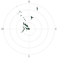
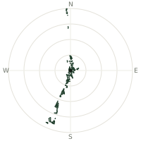
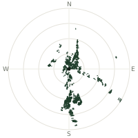
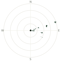
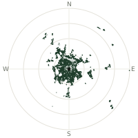
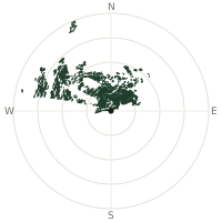
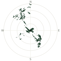
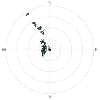
From Grand Canyon South Rim, the terrain-limited line of sight reaches up to 144 km. The single farthest piece of visible terrain lies 144 km to the south-southwest (bearing 211°), at 2,149 m elevation. These results account for Earth's curvature and standard atmospheric refraction, computed from 30-meter resolution Copernicus GLO-30 elevation data across 2,238,976 terrain samples.
Open the interactive visibility map →Visibility by direction
The horizon is most open toward the west-southwest, where sightlines run 89.9 km on average; terrain closes the view down fastest to the southeast, at 2.2 km.
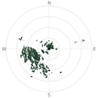
| N | 20.4 km | |
| NNE | 21.0 km | |
| NE | 17.1 km | |
| ENE | 29.6 km | |
| E | 21.7 km | |
| ESE | 3.0 km | |
| SE | 2.2 km | |
| SSE | 17.0 km | |
| S | 61.4 km | |
| SSW | 84.2 km | |
| SW | 82.8 km | |
| WSW | 89.9 km | |
| W | 77.4 km | |
| WNW | 53.5 km | |
| NW | 33.3 km | |
| NNW | 20.9 km |
Farthest named landmarks in view
69 named peaks, hills and headlands stand inside this viewshed. These are the farthest ones you could pick out on a clear day:
| Landmark | Visible distance | Direction | Elevation |
|---|---|---|---|
| Red Mountain | 135 km | SSW · 211° | 2,080 m |
| Yellowstone Point | 115 km | ENE · 77° | 1,794 m |
| Picacho Butte | 109 km | SSW · 212° | 2,183 m |
| Mount Logan | 105 km | WNW · 289° | 2,388 m |
| Craigs Knoll | 104 km | WNW · 296° | 2,188 m |
| Summit Mountain | 103 km | S · 181° | 2,373 m |
About Grand Canyon South Rim
The Grand Canyon spans 277 miles through northern Arizona, carved by the Colorado River over millions of years. Nearly two billion years of geological history lay exposed in its layered walls. The canyon reaches depths exceeding 1,800 meters and widths up to 29 kilometers.
Did you know?
- The canyon spans five of North America's seven life zones within its mile of elevation change, roughly the ecological equivalent of travelling from Mexico to Canada.
- The Havasupai people have lived within the canyon for more than 800 years; their village of Supai, at its base, remains one of the most isolated communities in the US, reachable only on foot, by mule, or by helicopter.
- Colorado River still actively erodes rock at average 0.2 millimeters per year.
- Multiple ancient rock formations and tributaries shape dramatic topography.
Frequently asked questions
How far can you see from Grand Canyon South Rim?
On a clear day the terrain allows a line of sight of up to 144 km from Grand Canyon South Rim. The average visible distance across all 360 directions is 39.7 km. Atmospheric conditions (haze, humidity) usually reduce practical visibility below the terrain-limited maximum.
What is the farthest point visible from Grand Canyon South Rim?
The farthest terrain visible from Grand Canyon South Rim lies 144 km to the south-southwest, at an elevation of 2,149 m. Earth's curvature and atmospheric refraction are accounted for in this calculation.
How high is Grand Canyon South Rim?
The observation point at Grand Canyon South Rim sits at 2,175 m above sea level (Copernicus GLO-30 elevation model).
How is this visibility map calculated?
UpToWhere traces lines of sight in 360 directions from the observer using 30 m-resolution Copernicus terrain data, correcting for Earth curvature and standard atmospheric refraction. You can run the same analysis for any point on Earth with the free calculator.
Run your own analysis
Want to know what you can see from your house, a summit you're planning to climb, or a plot of land? UpToWhere computes the same 360° viewshed for any point on Earth in seconds — free.
Try the viewshed calculator