 UpToWhere
What can you see from Uhuru Peak - Kilimanjaro?
Uhuru Peak: 'Freedom Peak' crowns Africa's highest mountain at 5,895 meters.
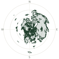
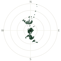
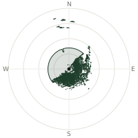
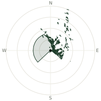
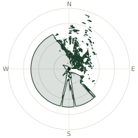
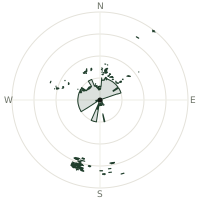
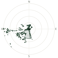
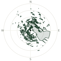
From Uhuru Peak - Kilimanjaro, the terrain-limited line of sight reaches up to 373 km. The single farthest piece of visible terrain lies 373 km to the north (bearing 9°), at 2,511 m elevation. These results account for Earth's curvature and standard atmospheric refraction, computed from 30-meter resolution Copernicus GLO-30 elevation data across 2,625,851 terrain samples.
Open the interactive visibility map →Visibility by direction
The horizon is most open toward the north, where sightlines run 287 km on average; terrain closes the view down fastest to the west-northwest, at 124 km.
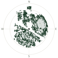
| N | 287 km | |
| NNE | 249 km | |
| NE | 268 km | |
| ENE | 277 km | |
| E | 272 km | |
| ESE | 222 km | |
| SE | 178 km | |
| SSE | 224 km | |
| S | 274 km | |
| SSW | 265 km | |
| SW | 251 km | |
| WSW | 204 km | |
| W | 200 km | |
| WNW | 124 km | |
| NW | 210 km | |
| NNW | 281 km |
Farthest named landmarks in view
667 named peaks, hills and headlands stand inside this viewshed. These are the farthest ones you could pick out on a clear day:
| Landmark | Visible distance | Direction | Elevation |
|---|---|---|---|
| Giant’s Billiard Table | 327 km | N · 2° | 3,358 m |
| Mugi Hill | 326 km | N · 1° | 3,495 m |
| Batian | 324 km | N · 359° | 5,078 m |
| Mount Kenya | 323 km | N · 359° | 5,199 m |
| Shiptons Peak | 322 km | N · 359° | 4,185 m |
| Tilman Peak | 322 km | N · 359° | 4,530 m |
About Uhuru Peak - Kilimanjaro
Kilimanjaro's summit, named Uhuru Peak ('freedom' in Swahili), was renamed in 1964 following Tanzania's independence as a symbolic gesture toward a liberated continent. At 5,895 meters, this dormant volcano holds Africa's largest remaining glaciers, though the ice has retreated catastrophically—losing over 90 percent since 1900, a visible chronicle of climate's inexorable march.
Did you know?
- Uhuru means 'freedom' in Swahili language
- Kilimanjaro is actually three volcanic cones in one — Kibo, Mawenzi, and Shira — with Uhuru Peak crowning Kibo, the tallest and youngest of the three.
- 5,895 meters (19,340 feet)—Africa's highest peak
- Lost over 90 percent of glacial ice since 1900
- Unlike most of the Seven Summits, Kilimanjaro requires no technical climbing gear — just fitness and time to acclimatize — making it one of the most accessible of the seven, with routes nicknamed the 'Whiskey Route' and 'Coca-Cola Route.'
Frequently asked questions
How far can you see from Uhuru Peak - Kilimanjaro?
On a clear day the terrain allows a line of sight of up to 373 km from Uhuru Peak - Kilimanjaro. The average visible distance across all 360 directions is 237 km. Atmospheric conditions (haze, humidity) usually reduce practical visibility below the terrain-limited maximum.
What is the farthest point visible from Uhuru Peak - Kilimanjaro?
The farthest terrain visible from Uhuru Peak - Kilimanjaro lies 373 km to the north, at an elevation of 2,511 m. Earth's curvature and atmospheric refraction are accounted for in this calculation.
How high is Uhuru Peak - Kilimanjaro?
The observation point at Uhuru Peak - Kilimanjaro sits at 5,889 m above sea level (Copernicus GLO-30 elevation model).
How is this visibility map calculated?
UpToWhere traces lines of sight in 360 directions from the observer using 30 m-resolution Copernicus terrain data, correcting for Earth curvature and standard atmospheric refraction. You can run the same analysis for any point on Earth with the free calculator.
Run your own analysis
Want to know what you can see from your house, a summit you're planning to climb, or a plot of land? UpToWhere computes the same 360° viewshed for any point on Earth in seconds — free.
Try the viewshed calculator