 UpToWhere
What can you see from Mount Marcy?
New York's highest peak was scaled for the first time on 5 August 1837, nearly 400 years after European settlement.
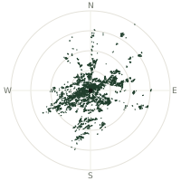
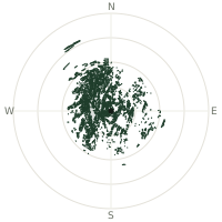
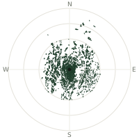
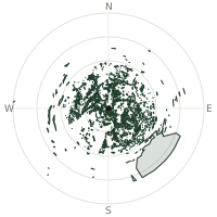
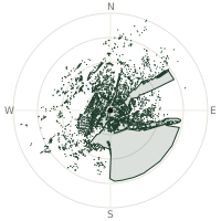
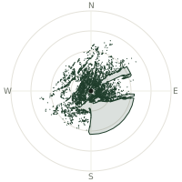
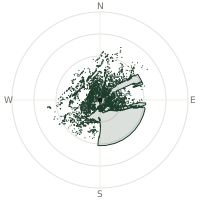
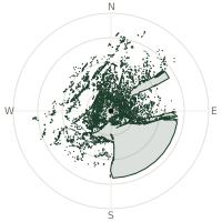
From Mount Marcy, the terrain-limited line of sight reaches up to 207 km. The single farthest piece of visible terrain lies 207 km to the south-southwest (bearing 193°), at 1,055 m elevation. These results account for Earth's curvature and standard atmospheric refraction, computed from 30-meter resolution Copernicus GLO-30 elevation data across 2,163,465 terrain samples.
Open the interactive visibility map →Visibility by direction
The horizon is most open toward the south-southeast, where sightlines run 155 km on average; terrain closes the view down fastest to the north, at 60.1 km.
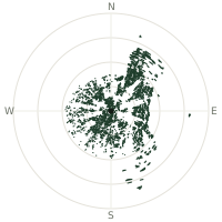
| N | 60.1 km | |
| NNE | 130 km | |
| NE | 151 km | |
| ENE | 99.1 km | |
| E | 88.3 km | |
| ESE | 94.4 km | |
| SE | 120 km | |
| SSE | 155 km | |
| S | 89.5 km | |
| SSW | 98.6 km | |
| SW | 73.4 km | |
| WSW | 90.2 km | |
| W | 79.7 km | |
| WNW | 72.3 km | |
| NW | 69.8 km | |
| NNW | 69.4 km |
Farthest named landmarks in view
821 named peaks, hills and headlands stand inside this viewshed. These are the farthest ones you could pick out on a clear day:
| Landmark | Visible distance | Direction | Elevation |
|---|---|---|---|
| Roundtop | 207 km | SSW · 193° | 1,052 m |
| Thomas Cole Mountain | 205 km | S · 185° | 1,202 m |
| Black Dome | 205 km | S · 185° | 1,211 m |
| Saddle Ball Mountain | 176 km | SSE · 160° | 985 m |
| Greylock Range | 175 km | SSE · 159° | 947 m |
| Mount Greylock | 175 km | SSE · 159° | 1,063 m |
About Mount Marcy
Mount Marcy, at 5,343 feet, is the highest point in New York State and the Adirondack Mountains, sitting in Essex County about twelve miles south of Lake Placid. The peak was named for William L. Marcy, who served as governor and championed the geological survey that finally mapped the Adirondacks. The first recorded ascent came remarkably late—on 5 August 1837—when a large party led by state geologist Ebenezer Emmons reached the summit. Lake Tear of the Clouds, at the col between Marcy and neighboring Skylight, is often cited as the Hudson River's highest source.
Did you know?
- The mountain's Algonquin name, Tahawus, means 'Cloud-Splitter,' a name still used for a nearby peak and a historic ironworks village at its base.
- At 5,343.1 feet, Mount Marcy is New York's highest and the crown of Adirondack Park.
- Naturalist and surveyor Verplanck Colvin, who mapped the Adirondacks in exhaustive detail in the 1870s, is credited with naming Lake Tear of the Clouds during his survey expeditions.
- The Van Hoevenberg Trail, 7.4 miles one way, is the most direct route; nearly 15 miles round-trip with 3,000+ feet of climbing.
- On a clear day, the summit offers views of 43 high peaks throughout the Adirondack High Peaks region.
Frequently asked questions
How far can you see from Mount Marcy?
On a clear day the terrain allows a line of sight of up to 207 km from Mount Marcy. The average visible distance across all 360 directions is 96.2 km. Atmospheric conditions (haze, humidity) usually reduce practical visibility below the terrain-limited maximum.
What is the farthest point visible from Mount Marcy?
The farthest terrain visible from Mount Marcy lies 207 km to the south-southwest, at an elevation of 1,055 m. Earth's curvature and atmospheric refraction are accounted for in this calculation.
How high is Mount Marcy?
The observation point at Mount Marcy sits at 1,635 m above sea level (Copernicus GLO-30 elevation model).
How is this visibility map calculated?
UpToWhere traces lines of sight in 360 directions from the observer using 30 m-resolution Copernicus terrain data, correcting for Earth curvature and standard atmospheric refraction. You can run the same analysis for any point on Earth with the free calculator.
Run your own analysis
Want to know what you can see from your house, a summit you're planning to climb, or a plot of land? UpToWhere computes the same 360° viewshed for any point on Earth in seconds — free.
Try the viewshed calculator