 UpToWhere
What can you see from Mount Mitchell?
Appalachia's highest throne: 6,684 feet of eastern grandeur.
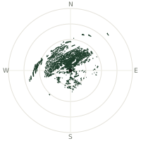
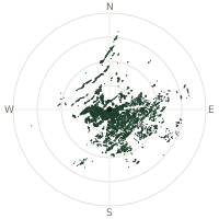
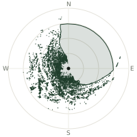
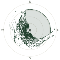
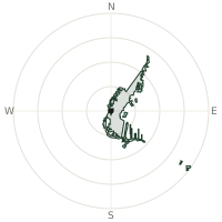
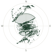
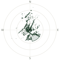
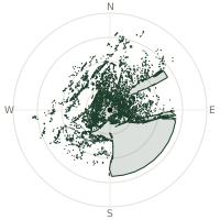
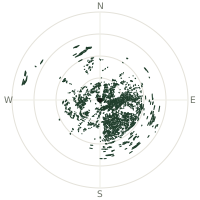
From Mount Mitchell, the terrain-limited line of sight reaches up to 210 km. The single farthest piece of visible terrain lies 210 km to the east-northeast (bearing 60°), at 960 m elevation. These results account for Earth's curvature and standard atmospheric refraction, computed from 30-meter resolution Copernicus GLO-30 elevation data across 2,221,439 terrain samples.
Open the interactive visibility map →Visibility by direction
The horizon is most open toward the west-northwest, where sightlines run 173 km on average; terrain closes the view down fastest to the north-northeast, at 58.6 km.
| N | 99.7 km | |
| NNE | 58.6 km | |
| NE | 88.7 km | |
| ENE | 141 km | |
| E | 159 km | |
| ESE | 155 km | |
| SE | 159 km | |
| SSE | 163 km | |
| S | 135 km | |
| SSW | 65.5 km | |
| SW | 84.2 km | |
| WSW | 90.1 km | |
| W | 83.0 km | |
| WNW | 173 km | |
| NW | 89.9 km | |
| NNW | 132 km |
Farthest named landmarks in view
694 named peaks, hills and headlands stand inside this viewshed. These are the farthest ones you could pick out on a clear day:
| Landmark | Visible distance | Direction | Elevation |
|---|---|---|---|
| Bull Mountain | 210 km | ENE · 60° | 977 m |
| Richwood Knob | 210 km | ENE · 60° | 977 m |
| Carter Mountain | 201 km | ENE · 61° | 709 m |
| Little Mountain | 192 km | SSE · 156° | 244 m |
| Cooks Wall Mountain | 191 km | ENE · 68° | 715 m |
| Cooks Wall | 191 km | ENE · 68° | 658 m |
About Mount Mitchell
Mount Mitchell crowns the Black Mountain subrange of North Carolina's Appalachians, holding the distinction of highest peak east of the Mississippi River. Measured in 1835 by University of North Carolina professor Elisha Mitchell, it has drawn hikers and scientists seeking the highest eastern vantage point.
Did you know?
- 6,684 feet above sea level—highest eastern peak
- Elisha Mitchell died in a fall from a waterfall on the mountain's slopes in 1857 while trying to reverify his own measurements against a rival's competing claim — and is buried at the summit that now bears his name.
- Public outrage over rampant logging near Mitchell's grave helped create Mount Mitchell State Park in 1915 — North Carolina's very first state park.
- First surveyed scientifically by Elisha Mitchell in 1835
- Protected by Mount Mitchell State Park and Pisgah National Forest
Frequently asked questions
How far can you see from Mount Mitchell?
On a clear day the terrain allows a line of sight of up to 210 km from Mount Mitchell. The average visible distance across all 360 directions is 117 km. Atmospheric conditions (haze, humidity) usually reduce practical visibility below the terrain-limited maximum.
What is the farthest point visible from Mount Mitchell?
The farthest terrain visible from Mount Mitchell lies 210 km to the east-northeast, at an elevation of 960 m. Earth's curvature and atmospheric refraction are accounted for in this calculation.
How high is Mount Mitchell?
The observation point at Mount Mitchell sits at 2,044 m above sea level (Copernicus GLO-30 elevation model).
How is this visibility map calculated?
UpToWhere traces lines of sight in 360 directions from the observer using 30 m-resolution Copernicus terrain data, correcting for Earth curvature and standard atmospheric refraction. You can run the same analysis for any point on Earth with the free calculator.
Run your own analysis
Want to know what you can see from your house, a summit you're planning to climb, or a plot of land? UpToWhere computes the same 360° viewshed for any point on Earth in seconds — free.
Try the viewshed calculator