 UpToWhere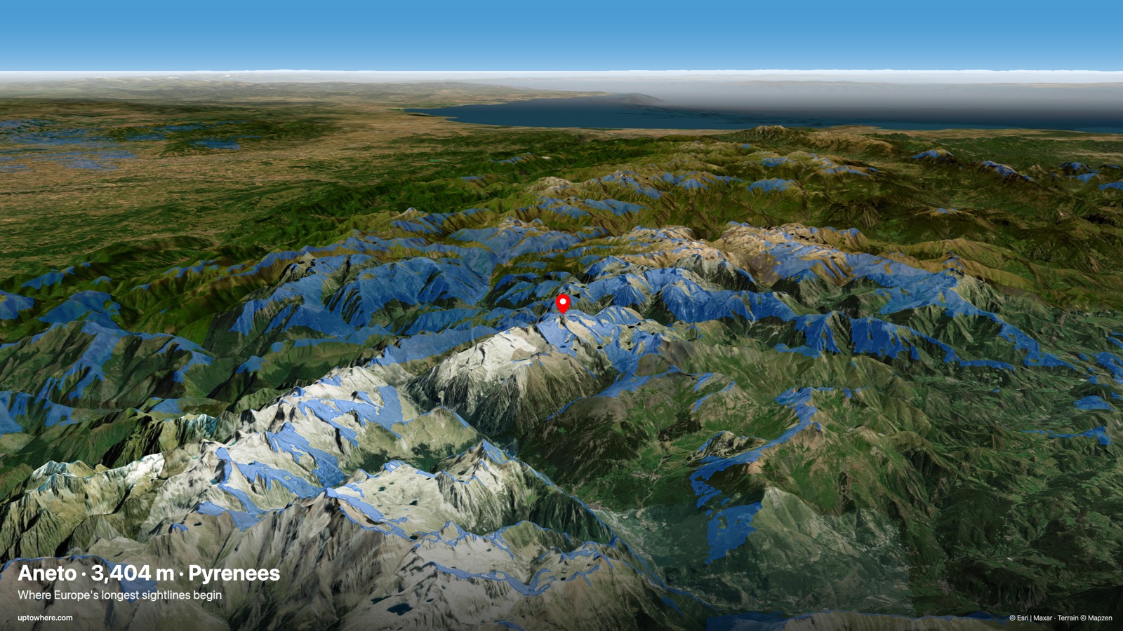
On a December night in 2024, Slovak photographer Richard Jezik climbed for ten hours through snow to a summit near Karagöl in Turkey's Pontic Mountains, waited out −12 °C and gale-force gusts, and at dawn photographed Shkhara, the highest peak in Georgia, from 493 km (306 mi) away, across the entire eastern Black Sea. Guinness World Records certified it as the longest line of sight ever photographed on Earth.
Half a thousand kilometres, eye to summit: roughly the distance from London to Cologne.
The record book of seeing far
| Distance | From → To | Year | Notes |
|---|---|---|---|
| 493 km (306 mi) | Near Karagöl (Turkey) → Shkhara (Georgia) | 2024 | Current world record (Guinness) |
| 483 km (300 mi) | Cerro Champaquí → Aconcagua (Argentina) | 2023 | Across the Argentine pampa to the highest Andes |
| 443 km (275 mi) | Pic de Finestrelles (Pyrenees) → Écrins massif (Alps) | 2016 | Marc Bret's famous dawn photograph that held the record for eight years |
| 408 km (254 mi) | Pic de Noufonts (Pyrenees) → Tête de l'Estrop (Alps) | 2019 | The most distant sunrise ever photographed |
| 330 km (205 mi) | Wellington → Mount Taranaki (New Zealand) | — | National record across the Tasman coast |
| 324 km (201 mi) | Puig d'en Galileu (Mallorca) → Pic de Saloria (Pyrenees) | — | Spain's classic: the Pyrenees seen from a Balearic island |
| 232 km (144 mi) | Snowdon → Merrick (UK) | 2015 | British Isles record, Wales to Scotland |
A few of these endpoints have pre-computed visibility pages you can explore: the Aneto, Puig de Massanella on Mallorca — a neighbour of the Spanish record's viewpoint — and Mont Blanc, spotted from a plane above Toulouse at 538 km (334 mi). Airborne sightings belong in a different category, though: from a cruising jet, seeing 500+ km is unremarkable, which is the subject of our guide to visibility from a plane.
The physics: why 500 km is possible on a round planet
Earth's curvature hides anything at sea level beyond about 5 km (3.1 mi) for a standing observer. Three things stretch that limit into the hundreds of kilometres:
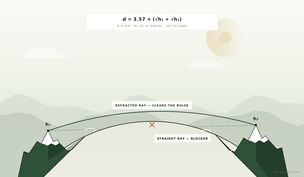
Height, on both ends. The horizon distance in kilometres is roughly 3.57 × √(height in metres). From 3,000 m (9,843 ft) that's 196 km (122 mi); and if the target also rises 5,000 m (16,404 ft), its summit pokes above your horizon from another 253 km (157 mi) further out. Tall observer + tall target is how you get past 400 km (249 mi):
maximum sightline ≈ 3.57 × (√h₁ + √h₂) [km, heights in m]
For Jezik's record: an observer near 3,000 m (9,843 ft) and a 5,193 m (17,037 ft) target give ≈ 450 km (280 mi) — the remaining distance is covered by the second factor.
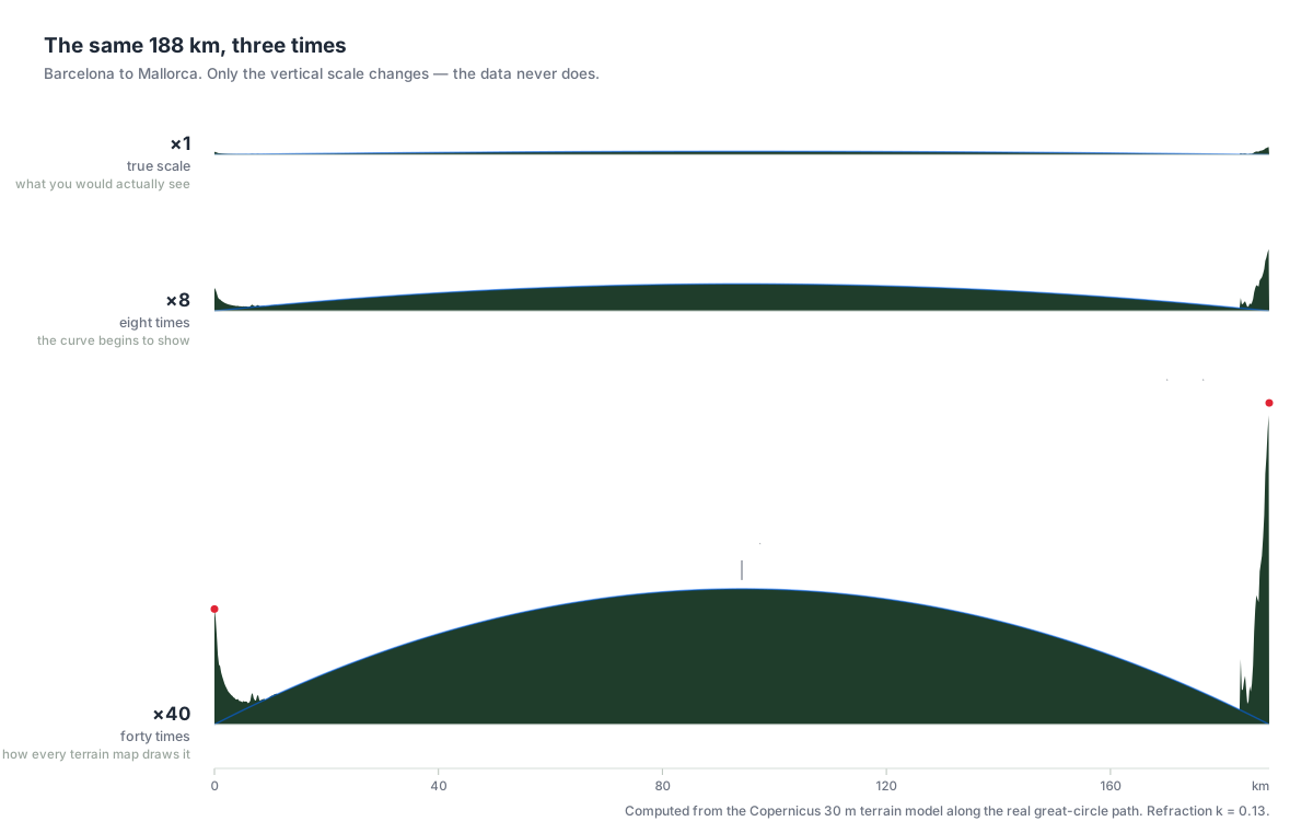
Atmospheric refraction. Air gets thinner with altitude, so light bends slightly downward, curving around the planet. Standard refraction effectively makes Earth about 15 % bigger for sightlines, adding tens of kilometres at these scales. Cold, stable winter air refracts more, which is why every record above was set in winter or at dawn, never on a summer afternoon.
Transparency. Seeing a summit 493 km away means looking through 493 km of air. Aerosols, humidity and haze usually cap practical visibility far below the geometric limit; record hunters wait for post-frontal polar air masses and shoot at dawn, when the target is backlit as a silhouette against the twilight.
Find your own record
Every sightline in the table above is terrain-limited — and terrain is computable. UpToWhere traces lines of sight from any point on Earth using 30 m Copernicus elevation data with curvature and refraction applied, in seconds:
- Run a 360° viewshed from any summit and see the farthest visible terrain, with distance and bearing.
- Use point-to-point mode to test a specific pair — your local peak and that distant range you think you've glimpsed.
- Browse 162 famous viewpoints already computed, from Everest to the Eiffel Tower.
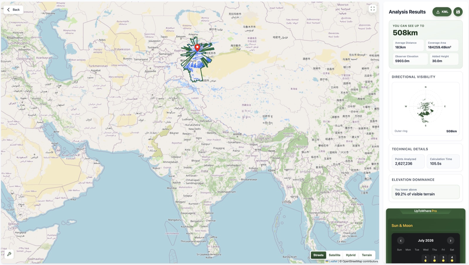
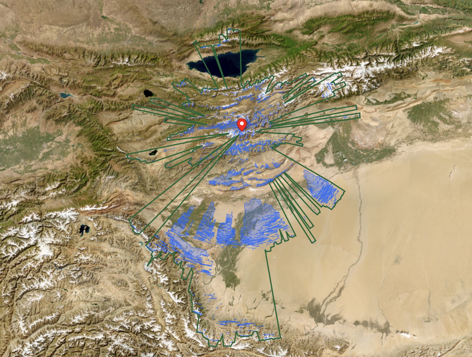
We pointed it at Pik Dankova (5,903 m/19,367 ft), on the Kyrgyzstan–China border, a Tian Shan summit that keeps coming up as a candidate for the next record — most recently in AllTheViews, Tom BH and Ryan Berger's brute-force search of every sightline on Earth, whose longest find (just over 530 km, on coarser 100 m elevation data) runs through this very corridor. Our terrain analysis identifies the longest known line of sight on Earth from this summit: 536 km (333 mi), south across the entire Tarim Basin to an unnamed ridge on the India–China border — a line that misses by just 8 metres at standard refraction and clears under the stronger refraction of a cold, stable dawn (the full point-to-point analysis). And with no help from unusual weather at all, the summit's standard-refraction sightline still reaches a clear 508 km (316 mi) into the Kunlun ranges above the Tibetan Plateau. That is longer than Jezik's photographed record. Nobody has stood on that summit at dawn with a camera to prove the air was clear enough on the day; but the terrain, at least, has no objection.
How far can you see from your mountain? Run it free
Frequently asked questions
What is the longest line of sight ever photographed?
493 km (306 mi), photographed by Richard Jezik on 15 December 2024: the summit of Shkhara in the Caucasus, seen from a peak near Karagöl in north-eastern Turkey, across the Black Sea. Guinness World Records lists it as the longest line of sight on Earth photographed.
Is there a theoretical maximum line of sight on Earth?
Sightlines beyond 500 km (311 mi) between the right pairs of high summits are geometrically possible with strong refraction, and the strongest candidates cluster in Central Asia, where AllTheViews, an independent brute-force search of every sightline on Earth, also places the global winner. UpToWhere's terrain analysis puts the longest known line of sight on Earth at 536 km (333 mi), from Pik Dankova on the Kyrgyzstan–China border to a ridge on the India–China border — clear only with favourable refraction — while the same summit's standard-refraction sightline reaches 508 km (316 mi) into the Kunlun ranges. Photographing one requires exceptional air clarity in exactly the right weather, which is why the photographed record still sits just under 500 km (311 mi).
Why can you see further in winter?
Cold, dense, stable air both refracts light more strongly (bending sightlines around Earth's curvature) and carries fewer aerosols and less humidity than summer air, so distant terrain stays visible instead of dissolving into haze.
How is a maximum sightline calculated?
From the observer's elevation, a ray is traced toward every direction over a digital elevation model, accounting for Earth's curvature and standard atmospheric refraction; the farthest terrain the ray touches is the maximum line of sight. UpToWhere runs this computation in 360 directions from any point using Copernicus GLO-30 data.