 UpToWhere
What can you see from Eiffel Tower?
Built in two years using 2.5 million rivets, it became the world's tallest man-made structure.
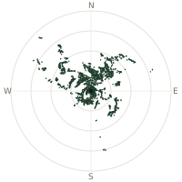
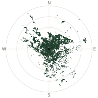
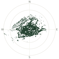
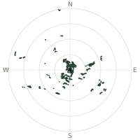
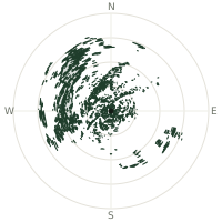
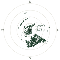
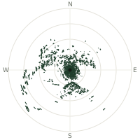
From Eiffel Tower, the terrain-limited line of sight reaches up to 80.2 km. The single farthest piece of visible terrain lies 80.2 km to the northwest (bearing 315°), at 202 m elevation. These results account for Earth's curvature and standard atmospheric refraction, computed from 30-meter resolution Copernicus GLO-30 elevation data across 1,923,489 terrain samples.
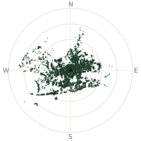
Open the interactive visibility map →Visibility by direction
The horizon is most open toward the east-southeast, where sightlines run 68.5 km on average; terrain closes the view down fastest to the southwest, at 37.9 km.
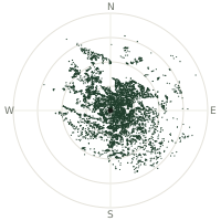
| N | 42.2 km | |
| NNE | 50.8 km | |
| NE | 53.9 km | |
| ENE | 53.3 km | |
| E | 56.1 km | |
| ESE | 68.5 km | |
| SE | 63.3 km | |
| SSE | 51.9 km | |
| S | 44.4 km | |
| SSW | 40.7 km | |
| SW | 37.9 km | |
| WSW | 38.2 km | |
| W | 38.7 km | |
| WNW | 41.8 km | |
| NW | 47.4 km | |
| NNW | 54.4 km |
About Eiffel Tower
The Eiffel Tower, designed by Gustave Eiffel, rose 300 metres high and opened to the public on May 15, 1889, as the entrance gateway to the International Exposition celebrating the centenary of the French Revolution. Built almost entirely of open-lattice wrought iron, the structure used more than 18,000 pieces of puddle iron and 2.5 million rivets, yet required only a small labour force and was completed in roughly two years. When finished, it was the world's tallest man-made structure, a record it held for forty years until the Chrysler Building surpassed it in 1930.
Did you know?
- Eiffel saved the tower from a planned 1909 demolition by promoting it as a radio transmission antenna, a scientific use that made it too valuable to tear down.
- Gustave Eiffel kept a private apartment near the top of the tower, where he entertained guests including Thomas Edison.
- The tower grows about 15 centimetres taller in summer, as heat causes its iron structure to expand.
- It is repainted by hand roughly every seven years, using about 60 tonnes of paint applied by a dedicated team of painters.
- During the Nazi occupation of Paris, resistance members reportedly cut the elevator cables, forcing German soldiers to climb the stairs to reach the top.
Frequently asked questions
How far can you see from Eiffel Tower?
On a clear day the terrain allows a line of sight of up to 80.2 km from Eiffel Tower. The average visible distance across all 360 directions is 49.0 km. Atmospheric conditions (haze, humidity) usually reduce practical visibility below the terrain-limited maximum.
What is the farthest point visible from Eiffel Tower?
The farthest terrain visible from Eiffel Tower lies 80.2 km to the northwest, at an elevation of 202 m. Earth's curvature and atmospheric refraction are accounted for in this calculation.
How high is Eiffel Tower?
The observation point at Eiffel Tower sits at 316 m above sea level (Copernicus GLO-30 elevation model).
How is this visibility map calculated?
UpToWhere traces lines of sight in 360 directions from the observer using 30 m-resolution Copernicus terrain data, correcting for Earth curvature and standard atmospheric refraction. You can run the same analysis for any point on Earth with the free calculator.
Run your own analysis
Want to know what you can see from your house, a summit you're planning to climb, or a plot of land? UpToWhere computes the same 360° viewshed for any point on Earth in seconds — free.
Try the viewshed calculator