 UpToWhere
What can you see from Matterhorn?
The last great Alpine summit to fall, and it cost four lives on the way down.
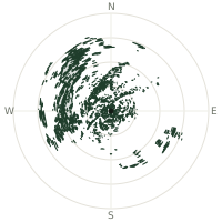
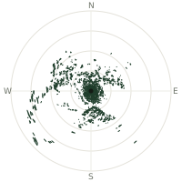
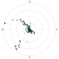
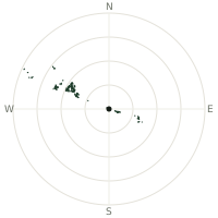
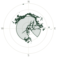
From Matterhorn, the terrain-limited line of sight reaches up to 313 km. The single farthest piece of visible terrain lies 313 km to the southeast (bearing 129°), at 1,944 m elevation. These results account for Earth's curvature and standard atmospheric refraction, computed from 30-meter resolution Copernicus GLO-30 elevation data across 2,483,693 terrain samples.
Open the interactive visibility map →Visibility by direction
The horizon is most open toward the southeast, where sightlines run 236 km on average; terrain closes the view down fastest to the east-southeast, at 15.4 km.
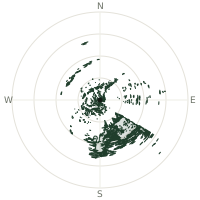
| N | 87.1 km | |
| NNE | 55.9 km | |
| NE | 66.9 km | |
| ENE | 106 km | |
| E | 172 km | |
| ESE | 15.4 km | |
| SE | 236 km | |
| SSE | 188 km | |
| S | 202 km | |
| SSW | 137 km | |
| SW | 119 km | |
| WSW | 86.8 km | |
| W | 61.6 km | |
| WNW | 106 km | |
| NW | 116 km | |
| NNW | 127 km |
Farthest named landmarks in view
1,227 named peaks, hills and headlands stand inside this viewshed. These are the farthest ones you could pick out on a clear day:
| Landmark | Visible distance | Direction | Elevation |
|---|---|---|---|
| Monte Lagoni | 312 km | SE · 129° | 1,962 m |
| Monte Cisa | 284 km | SE · 130° | 1,701 m |
| Monte Prampa | 284 km | SE · 129° | 1,698 m |
| Monte Bagioletto | 284 km | SE · 130° | 1,760 m |
| Cima Belfiore | 279 km | SE · 132° | 1,811 m |
| Le Housserat | 270 km | N · 353° | 955 m |
About Matterhorn
The Matterhorn's four near-symmetrical faces, each pointing roughly to a different compass direction, made it look unclimbable for decades even though it was not the Alps' tallest peak. Edward Whymper's team of seven finally reached the summit on 14 July 1865, but four died on the descent when a rope snapped, a disaster often described as the end of the golden age of alpinism. The mountain straddles Switzerland and Italy above Zermatt and Breuil-Cervinia, and its razor silhouette has since been borrowed for everything from a chocolate bar to a theme-park ride.
Did you know?
- Just three days after Whymper's team summited from Switzerland, Italian guide Jean-Antoine Carrel led a rival team to the top from the Italian side, capping a race that had gripped Europe for weeks.
- The frayed rope that broke that day is preserved behind glass in Zermatt's Matterhorn Museum.
- On a clear day, climbers on the summit can pick out Mont Blanc, Monte Rosa, and the Bernese Alps across the horizon.
- The mountain's pyramidal shape is widely credited as the inspiration for the Toblerone chocolate bar's silhouette.
- More than 500 climbers have died on the Matterhorn since 1865, making it one of the deadliest peaks in the Alps.
Frequently asked questions
How far can you see from Matterhorn?
On a clear day the terrain allows a line of sight of up to 313 km from Matterhorn. The average visible distance across all 360 directions is 118 km. Atmospheric conditions (haze, humidity) usually reduce practical visibility below the terrain-limited maximum.
What is the farthest point visible from Matterhorn?
The farthest terrain visible from Matterhorn lies 313 km to the southeast, at an elevation of 1,944 m. Earth's curvature and atmospheric refraction are accounted for in this calculation.
How high is Matterhorn?
The observation point at Matterhorn sits at 4,340 m above sea level (Copernicus GLO-30 elevation model).
How is this visibility map calculated?
UpToWhere traces lines of sight in 360 directions from the observer using 30 m-resolution Copernicus terrain data, correcting for Earth curvature and standard atmospheric refraction. You can run the same analysis for any point on Earth with the free calculator.
Run your own analysis
Want to know what you can see from your house, a summit you're planning to climb, or a plot of land? UpToWhere computes the same 360° viewshed for any point on Earth in seconds — free.
Try the viewshed calculator