 UpToWhere
What can you see from Leaning Tower of Pisa?
It started leaning before it was even finished, and builders just kept going.
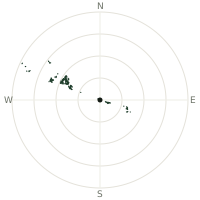
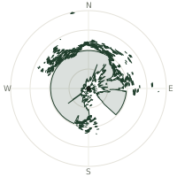
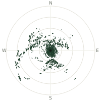
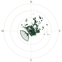
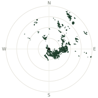
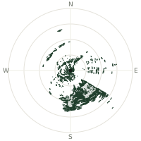
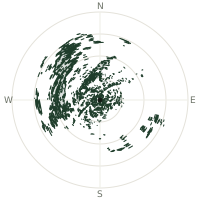
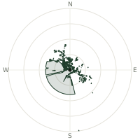
From Leaning Tower of Pisa, the terrain-limited line of sight reaches up to 220 km. The single farthest piece of visible terrain lies 220 km to the west-northwest (bearing 284°), at 2,559 m elevation. These results account for Earth's curvature and standard atmospheric refraction, computed from 30-meter resolution Copernicus GLO-30 elevation data across 1,859,883 terrain samples.
Open the interactive visibility map →Visibility by direction
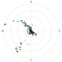
The horizon is most open toward the southwest, where sightlines run 94.5 km on average; terrain closes the view down fastest to the east-northeast, at 10.2 km.
| N | 34.6 km | |
| NNE | 16.6 km | |
| NE | 13.9 km | |
| ENE | 10.2 km | |
| E | 12.4 km | |
| ESE | 40.3 km | |
| SE | 49.1 km | |
| SSE | 37.2 km | |
| S | 27.0 km | |
| SSW | 62.4 km | |
| SW | 94.5 km | |
| WSW | 31.5 km | |
| W | 31.5 km | |
| WNW | 60.5 km | |
| NW | 91.8 km | |
| NNW | 46.6 km |
Farthest named landmarks in view
59 named peaks, hills and headlands stand inside this viewshed. These are the farthest ones you could pick out on a clear day:
| Landmark | Visible distance | Direction | Elevation |
|---|---|---|---|
| Cima della Brignola | 216 km | WNW · 285° | 2,472 m |
| Cima Ferlette | 216 km | WNW · 285° | 2,394 m |
| Monte Fantino | 216 km | WNW · 286° | 2,428 m |
| Monte Mongioie | 216 km | WNW · 284° | 2,630 m |
| Monte Rotondo | 214 km | WNW · 284° | 2,495 m |
| Bric di Canoia | 214 km | WNW · 284° | 2,521 m |
About Leaning Tower of Pisa
Construction on this bell tower for Pisa Cathedral began in 1173 on ground too soft to support it, and it started tilting after only three of its eight stories were built. Wars repeatedly halted work, stretching construction across nearly two centuries; builders compensated for the lean by making upper floors slightly taller on one side, giving the tower a faint banana-like curve. By 1990 the tilt had grown dangerous enough to close it to the public.
Did you know?
- Engineers removed 38 cubic metres of soil from beneath the raised side between 1993 and 2001, reducing the tilt from 5.5 to 3.97 degrees.
- After a decade of closure, the tower reopened in 2001 and was declared stable for at least 300 years.
- Builders straightened later floors slightly to counteract the lean, giving the tower a subtle banana-shaped curve rather than a straight tilt.
- The legend that Galileo dropped balls of different weights from the tower to test gravity has no solid historical evidence behind it.
- The tower's seven bells, one for each note of the musical scale, sit in the belfry at the very top.
Frequently asked questions
How far can you see from Leaning Tower of Pisa?
On a clear day the terrain allows a line of sight of up to 220 km from Leaning Tower of Pisa. The average visible distance across all 360 directions is 41.3 km. Atmospheric conditions (haze, humidity) usually reduce practical visibility below the terrain-limited maximum.
What is the farthest point visible from Leaning Tower of Pisa?
The farthest terrain visible from Leaning Tower of Pisa lies 220 km to the west-northwest, at an elevation of 2,559 m. Earth's curvature and atmospheric refraction are accounted for in this calculation.
How high is Leaning Tower of Pisa?
The observation point at Leaning Tower of Pisa sits at 68 m above sea level (Copernicus GLO-30 elevation model).
How is this visibility map calculated?
UpToWhere traces lines of sight in 360 directions from the observer using 30 m-resolution Copernicus terrain data, correcting for Earth curvature and standard atmospheric refraction. You can run the same analysis for any point on Earth with the free calculator.
Run your own analysis
Want to know what you can see from your house, a summit you're planning to climb, or a plot of land? UpToWhere computes the same 360° viewshed for any point on Earth in seconds — free.
Try the viewshed calculator