 UpToWhere
What can you see from Cotopaxi?
An ice-capped stratovolcano that has erupted 87 times in recorded history.
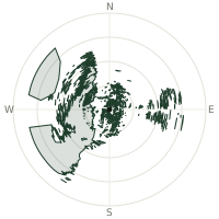
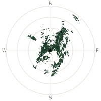
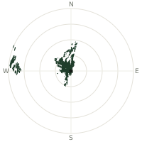
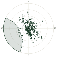
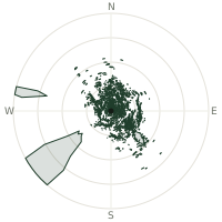
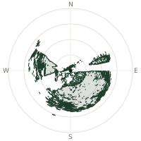
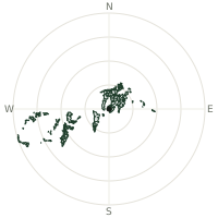
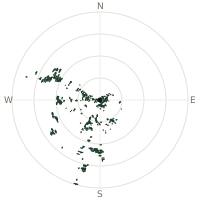
From Cotopaxi, the terrain-limited line of sight reaches up to 309 km. The single farthest piece of visible terrain lies 309 km to the east-southeast (bearing 104°), at 298 m elevation. These results account for Earth's curvature and standard atmospheric refraction, computed from 30-meter resolution Copernicus GLO-30 elevation data across 2,626,442 terrain samples.
Open the interactive visibility map →Visibility by direction
The horizon is most open toward the west-northwest, where sightlines run 294 km on average; terrain closes the view down fastest to the southwest, at 74.3 km.
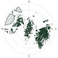
| N | 126 km | |
| NNE | 146 km | |
| NE | 90.9 km | |
| ENE | 150 km | |
| E | 256 km | |
| ESE | 285 km | |
| SE | 282 km | |
| SSE | 154 km | |
| S | 136 km | |
| SSW | 134 km | |
| SW | 74.3 km | |
| WSW | 141 km | |
| W | 200 km | |
| WNW | 294 km | |
| NW | 255 km | |
| NNW | 166 km |
Farthest named landmarks in view
120 named peaks, hills and headlands stand inside this viewshed. These are the farthest ones you could pick out on a clear day:
| Landmark | Visible distance | Direction | Elevation |
|---|---|---|---|
| Cerro Corralitos | 253 km | WSW · 254° | 474 m |
| Cabo de San Francisco | 235 km | NW · 309° | 1 m |
| Cerros de Balsamo | 211 km | W · 265° | 103 m |
| Loma Largo | 206 km | NNE · 28° | 3,340 m |
| Loma La Gorgona | 206 km | NNE · 27° | 3,475 m |
| Loma El Caliente | 205 km | NNE · 28° | 3,389 m |
About Cotopaxi
Cotopaxi is Ecuador's second-highest peak at 5,897 metres and ranks among the world's highest active volcanoes. Its first documented eruption was in 1534, and it erupts regularly: its most violent historical events occurred in 1742, 1744, 1768, and 1877, the latter sending lahars more than 100 kilometers into the Pacific and Amazon basins, draining entire valleys.
Did you know?
- First recorded eruption in 1534; one of the earliest documented volcanoes in South America.
- The June 1877 eruption melted the entire ice cap and sent lahars over 100 km into two ocean basins.
- In October 2022, Cotopaxi began an eruption producing around 8,000 earthquakes before subsiding.
- With 87 known eruptions, it is one of Ecuador's most active volcanoes by frequency.
- Ice and snow permanently cap the summit, though eruptions periodically melt the entire cap.
Frequently asked questions
How far can you see from Cotopaxi?
On a clear day the terrain allows a line of sight of up to 309 km from Cotopaxi. The average visible distance across all 360 directions is 181 km. Atmospheric conditions (haze, humidity) usually reduce practical visibility below the terrain-limited maximum.
What is the farthest point visible from Cotopaxi?
The farthest terrain visible from Cotopaxi lies 309 km to the east-southeast, at an elevation of 298 m. Earth's curvature and atmospheric refraction are accounted for in this calculation.
How high is Cotopaxi?
The observation point at Cotopaxi sits at 5,893 m above sea level (Copernicus GLO-30 elevation model).
How is this visibility map calculated?
UpToWhere traces lines of sight in 360 directions from the observer using 30 m-resolution Copernicus terrain data, correcting for Earth curvature and standard atmospheric refraction. You can run the same analysis for any point on Earth with the free calculator.
Run your own analysis
Want to know what you can see from your house, a summit you're planning to climb, or a plot of land? UpToWhere computes the same 360° viewshed for any point on Earth in seconds — free.
Try the viewshed calculator