 UpToWhere
What can you see from Vinicunca (Rainbow Mountain)?
Rainbow Mountain, whose mineral stripes were hidden under ice until tourists spotted them in 2015.
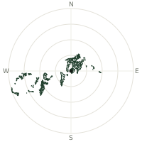
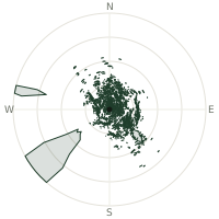
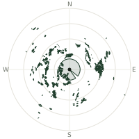
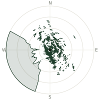
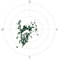
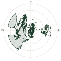
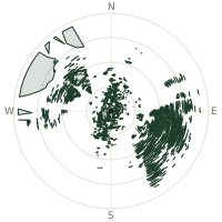
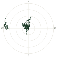
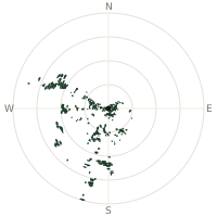
From Vinicunca (Rainbow Mountain), the terrain-limited line of sight reaches up to 225 km. The single farthest piece of visible terrain lies 225 km to the south-southwest (bearing 196°), at 6,288 m elevation. These results account for Earth's curvature and standard atmospheric refraction, computed from 30-meter resolution Copernicus GLO-30 elevation data across 2,554,566 terrain samples.
Open the interactive visibility map →Visibility by direction
The horizon is most open toward the west-northwest, where sightlines run 122 km on average; terrain closes the view down fastest to the north, at 2.9 km.
| N | 2.9 km | |
| NNE | 7.2 km | |
| NE | 15.8 km | |
| ENE | 28.2 km | |
| E | 28.8 km | |
| ESE | 20.2 km | |
| SE | 34.6 km | |
| SSE | 60.0 km | |
| S | 114 km | |
| SSW | 121 km | |
| SW | 40.3 km | |
| WSW | 66.3 km | |
| W | 68.6 km | |
| WNW | 122 km | |
| NW | 26.7 km | |
| NNW | 3.7 km |
Farthest named landmarks in view
161 named peaks, hills and headlands stand inside this viewshed. These are the farthest ones you could pick out on a clear day:
| Landmark | Visible distance | Direction | Elevation |
|---|---|---|---|
| Nevado Hualca Hualca | 213 km | SSW · 196° | 6,025 m |
| Nevado Coisopacana | 198 km | WNW · 287° | 5,176 m |
| Nevado Mismi | 187 km | SSW · 193° | 5,597 m |
| Cerro Surihuiri | 186 km | SSW · 199° | 5,556 m |
| Cerro Ajo Colluna | 184 km | SSW · 193° | 5,255 m |
| Nevado Culluncuya | 183 km | SSW · 197° | 5,556 m |
About Vinicunca (Rainbow Mountain)
Vinicunca, known as Rainbow Mountain or Montaña de Siete Colores, rises to 5,036 metres in Peru's Andes. For millions of years its brilliant mineral striping lay hidden beneath thick glacier ice. Regional warming melted the snowpack in 2013, and photos shared by trekking tourists in 2015 sparked global interest. The mountain's distinctive bands—reds, purples, greens, and golds—come from iron oxide, copper, and other mineral deposits. Today it attracts roughly 1,500 visitors daily.
Did you know?
- Became a global tourist attraction after photos shared in 2015 following glacier melt in 2013.
- The sudden tourism boom has brought both livelihoods and strain: local Quechua communities now manage entrance fees and horse rentals, while erosion from thousands of daily footsteps worries conservationists.
- At 5,036 metres, it is located on the road to Ausangate mountain in the Cusco region.
- Rainbow Mountain is now the second-most visited site in the Cusco region after Machu Picchu.
- Thick glacier ice hid the stripes for millennia until regional warming exposed the mineral deposits.
Frequently asked questions
How far can you see from Vinicunca (Rainbow Mountain)?
On a clear day the terrain allows a line of sight of up to 225 km from Vinicunca (Rainbow Mountain). The average visible distance across all 360 directions is 47.4 km. Atmospheric conditions (haze, humidity) usually reduce practical visibility below the terrain-limited maximum.
What is the farthest point visible from Vinicunca (Rainbow Mountain)?
The farthest terrain visible from Vinicunca (Rainbow Mountain) lies 225 km to the south-southwest, at an elevation of 6,288 m. Earth's curvature and atmospheric refraction are accounted for in this calculation.
How high is Vinicunca (Rainbow Mountain)?
The observation point at Vinicunca (Rainbow Mountain) sits at 5,084 m above sea level (Copernicus GLO-30 elevation model).
How is this visibility map calculated?
UpToWhere traces lines of sight in 360 directions from the observer using 30 m-resolution Copernicus terrain data, correcting for Earth curvature and standard atmospheric refraction. You can run the same analysis for any point on Earth with the free calculator.
Run your own analysis
Want to know what you can see from your house, a summit you're planning to climb, or a plot of land? UpToWhere computes the same 360° viewshed for any point on Earth in seconds — free.
Try the viewshed calculator