 UpToWhere
What can you see from Salar de Uyuni (Isla Incahuasi)?
World's largest salt flat: a crystalline mirror 10,582 square kilometers.
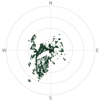
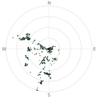
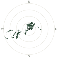
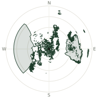
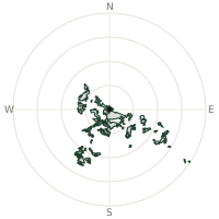
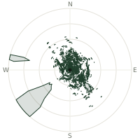
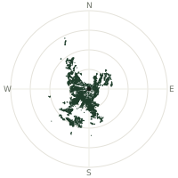
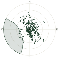
From Salar de Uyuni (Isla Incahuasi), the terrain-limited line of sight reaches up to 182 km. The single farthest piece of visible terrain lies 182 km to the east-southeast (bearing 115°), at 5,615 m elevation. These results account for Earth's curvature and standard atmospheric refraction, computed from 30-meter resolution Copernicus GLO-30 elevation data across 2,420,841 terrain samples.
Open the interactive visibility map →Visibility by direction
The horizon is most open toward the northwest, where sightlines run 102 km on average; terrain closes the view down fastest to the southeast, at 10.3 km.
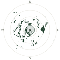
| N | 47.8 km | |
| NNE | 72.0 km | |
| NE | 82.9 km | |
| ENE | 96.5 km | |
| E | 100 km | |
| ESE | 55.0 km | |
| SE | 10.3 km | |
| SSE | 83.6 km | |
| S | 52.3 km | |
| SSW | 75.2 km | |
| SW | 91.1 km | |
| WSW | 90.0 km | |
| W | 96.0 km | |
| WNW | 85.6 km | |
| NW | 102 km | |
| NNW | 61.2 km |
Farthest named landmarks in view
103 named peaks, hills and headlands stand inside this viewshed. These are the farthest ones you could pick out on a clear day:
| Landmark | Visible distance | Direction | Elevation |
|---|---|---|---|
| Cerro Chorolque | 182 km | ESE · 115° | 5,615 m |
| Cerro Palpana | 172 km | SSW · 213° | 6,040 m |
| Cerro Cabaraya | 165 km | NW · 317° | 5,869 m |
| Cerro Chela | 158 km | SW · 215° | 5,644 m |
| Cerro Tata Sabaya | 155 km | NW · 322° | 5,430 m |
| Cerro Jatun Wila | 144 km | NE · 50° | 5,214 m |
About Salar de Uyuni (Isla Incahuasi)
Salar de Uyuni in southwestern Bolivia spans 10,582 square kilometers at 3,656 meters elevation, covered by 8 meters of salt. Containing 10 billion tonnes of salt and 23 million tonnes of lithium, it's Earth's largest salt flat. After rain, a thin water layer transforms the surface into the world's largest mirror.
Did you know?
- Isla Incahuasi, a rocky outcrop in the middle of the flat, is covered in giant cacti up to 12 metres tall — a coral-covered island left over from when the whole area lay underwater.
- Elevation 3,656 meters above sea level in southwestern Bolivia.
- Salt layer 8 meters thick across the entire flat.
- The flat is so extraordinarily level, varying by less than a metre across its entire surface, that scientists use it to calibrate satellite altimeters from orbit.
- Bolivia is estimated to hold one of the world's largest shares of untapped lithium reserves here, a resource increasingly sought after for batteries.
Frequently asked questions
How far can you see from Salar de Uyuni (Isla Incahuasi)?
On a clear day the terrain allows a line of sight of up to 182 km from Salar de Uyuni (Isla Incahuasi). The average visible distance across all 360 directions is 75.0 km. Atmospheric conditions (haze, humidity) usually reduce practical visibility below the terrain-limited maximum.
What is the farthest point visible from Salar de Uyuni (Isla Incahuasi)?
The farthest terrain visible from Salar de Uyuni (Isla Incahuasi) lies 182 km to the east-southeast, at an elevation of 5,615 m. Earth's curvature and atmospheric refraction are accounted for in this calculation.
How high is Salar de Uyuni (Isla Incahuasi)?
The observation point at Salar de Uyuni (Isla Incahuasi) sits at 3,723 m above sea level (Copernicus GLO-30 elevation model).
How is this visibility map calculated?
UpToWhere traces lines of sight in 360 directions from the observer using 30 m-resolution Copernicus terrain data, correcting for Earth curvature and standard atmospheric refraction. You can run the same analysis for any point on Earth with the free calculator.
Run your own analysis
Want to know what you can see from your house, a summit you're planning to climb, or a plot of land? UpToWhere computes the same 360° viewshed for any point on Earth in seconds — free.
Try the viewshed calculator