 UpToWhere
What can you see from Mount Katahdin?
Maine's rugged giant marks the northern end of the Appalachian Trail.
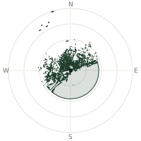
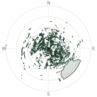
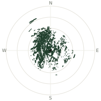
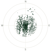
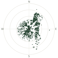
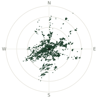
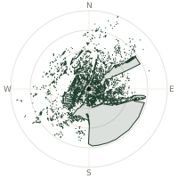
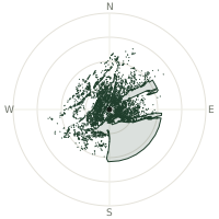
From Mount Katahdin, the terrain-limited line of sight reaches up to 221 km. The single farthest piece of visible terrain lies 221 km to the northwest (bearing 319°), at 1,103 m elevation. These results account for Earth's curvature and standard atmospheric refraction, computed from 30-meter resolution Copernicus GLO-30 elevation data across 2,158,494 terrain samples.
Open the interactive visibility map →Visibility by direction
The horizon is most open toward the northwest, where sightlines run 156 km on average; terrain closes the view down fastest to the northeast, at 0.0 km.
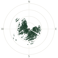
| N | 0.0 km | |
| NNE | 0.0 km | |
| NE | 0.0 km | |
| ENE | 20.2 km | |
| E | 132 km | |
| ESE | 105 km | |
| SE | 131 km | |
| SSE | 130 km | |
| S | 146 km | |
| SSW | 110 km | |
| SW | 121 km | |
| WSW | 153 km | |
| W | 108 km | |
| WNW | 127 km | |
| NW | 156 km | |
| NNW | 33.8 km |
Farthest named landmarks in view
358 named peaks, hills and headlands stand inside this viewshed. These are the farthest ones you could pick out on a clear day:
| Landmark | Visible distance | Direction | Elevation |
|---|---|---|---|
| Deer Mountain | 186 km | WSW · 238° | 1,050 m |
| Mont Mégantic | 181 km | WSW · 255° | 1,102 m |
| West Kennebago Mountain | 173 km | WSW · 240° | 1,130 m |
| Mount Pleasant | 172 km | ESE · 107° | 291 m |
| Mount Blue | 172 km | SW · 221° | 973 m |
| Level Hill | 171 km | SSW · 193° | 191 m |
About Mount Katahdin
Mount Katahdin, meaning 'Great Mountain' in Penobscot, rises 1,606 meters in Maine's Baxter State Park. Baxter Peak on the summit serves as the official northern terminus of the famous 2,190-mile Appalachian Trail. The mountain presents one of the most challenging alpine hikes on the entire trail.
Did you know?
- Height 5,269 feet (1,606 meters); highest mountain in Maine state.
- Maine Governor Percival Baxter personally bought the surrounding land parcel by parcel starting in 1930 and donated it to the state on the condition it remain 'forever wild,' banning roads, development, and motorized access.
- Penobscot name Katahdin translates to 'Great Mountain' in English.
- Challenging trail averages 8-12 hours round-trip; considered most difficult hike on AT.
Frequently asked questions
How far can you see from Mount Katahdin?
On a clear day the terrain allows a line of sight of up to 221 km from Mount Katahdin. The average visible distance across all 360 directions is 92.1 km. Atmospheric conditions (haze, humidity) usually reduce practical visibility below the terrain-limited maximum.
What is the farthest point visible from Mount Katahdin?
The farthest terrain visible from Mount Katahdin lies 221 km to the northwest, at an elevation of 1,103 m. Earth's curvature and atmospheric refraction are accounted for in this calculation.
How high is Mount Katahdin?
The observation point at Mount Katahdin sits at 1,599 m above sea level (Copernicus GLO-30 elevation model).
How is this visibility map calculated?
UpToWhere traces lines of sight in 360 directions from the observer using 30 m-resolution Copernicus terrain data, correcting for Earth curvature and standard atmospheric refraction. You can run the same analysis for any point on Earth with the free calculator.
Run your own analysis
Want to know what you can see from your house, a summit you're planning to climb, or a plot of land? UpToWhere computes the same 360° viewshed for any point on Earth in seconds — free.
Try the viewshed calculator