 UpToWhere
What can you see from Mount Whitney?
Highest point in the continental United States: 14,505 feet of Sierra granite.
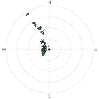
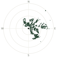
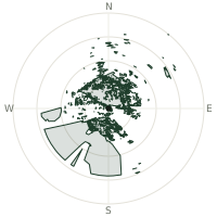
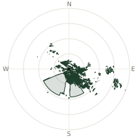
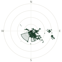
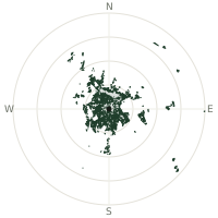
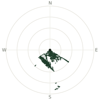
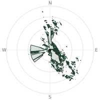
From Mount Whitney, the terrain-limited line of sight reaches up to 322 km. The single farthest piece of visible terrain lies 322 km to the west-northwest (bearing 282°), at 1,148 m elevation. These results account for Earth's curvature and standard atmospheric refraction, computed from 30-meter resolution Copernicus GLO-30 elevation data across 2,491,790 terrain samples.
Open the interactive visibility map →Visibility by direction
The horizon is most open toward the south-southeast, where sightlines run 258 km on average; terrain closes the view down fastest to the west-northwest, at 55.7 km.
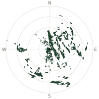
| N | 90.7 km | |
| NNE | 182 km | |
| NE | 221 km | |
| ENE | 207 km | |
| E | 249 km | |
| ESE | 149 km | |
| SE | 131 km | |
| SSE | 258 km | |
| S | 196 km | |
| SSW | 212 km | |
| SW | 142 km | |
| WSW | 82.2 km | |
| W | 165 km | |
| WNW | 55.7 km | |
| NW | 88.9 km | |
| NNW | 72.3 km |
Farthest named landmarks in view
422 named peaks, hills and headlands stand inside this viewshed. These are the farthest ones you could pick out on a clear day:
| Landmark | Visible distance | Direction | Elevation |
|---|---|---|---|
| Santa Cruz Mountains | 322 km | WNW · 282° | 1,136 m |
| Loma Prieta | 322 km | WNW · 282° | 1,148 m |
| Mount Chual | 322 km | WNW · 282° | 1,060 m |
| Crystal Peak | 322 km | WNW · 282° | 1,095 m |
| Loma Chiquita | 320 km | WNW · 282° | 792 m |
| Lake Peak | 305 km | SSE · 153° | 3,095 m |
About Mount Whitney
Mount Whitney stands as the highest peak in the contiguous United States, a granite sentinel in the Sierra Nevada range. Named in 1864 for California's state geologist Josiah Whitney, it marks the southern terminus of the legendary John Muir Trail, stretching 211.9 miles of wilderness connection to Yosemite Valley.
Did you know?
- A stone hut built in 1909 for weather research, the Smithsonian Institution Shelter, still stands at the summit today — one of the highest stone structures in the country.
- Located in California's Sierra Nevada range
- The summit sits just 136 kilometres from Badwater Basin in Death Valley, the lowest point in the contiguous United States — the highest and lowest spots in the Lower 48 lie remarkably close together.
- Demand to climb the standard trail is so high that the U.S. Forest Service allocates day-hike permits by lottery, with only around a one-in-three chance of winning one most years.
- West slope protected by Sequoia National Park
Frequently asked questions
How far can you see from Mount Whitney?
On a clear day the terrain allows a line of sight of up to 322 km from Mount Whitney. The average visible distance across all 360 directions is 156 km. Atmospheric conditions (haze, humidity) usually reduce practical visibility below the terrain-limited maximum.
What is the farthest point visible from Mount Whitney?
The farthest terrain visible from Mount Whitney lies 322 km to the west-northwest, at an elevation of 1,148 m. Earth's curvature and atmospheric refraction are accounted for in this calculation.
How high is Mount Whitney?
The observation point at Mount Whitney sits at 4,419 m above sea level (Copernicus GLO-30 elevation model).
How is this visibility map calculated?
UpToWhere traces lines of sight in 360 directions from the observer using 30 m-resolution Copernicus terrain data, correcting for Earth curvature and standard atmospheric refraction. You can run the same analysis for any point on Earth with the free calculator.
Run your own analysis
Want to know what you can see from your house, a summit you're planning to climb, or a plot of land? UpToWhere computes the same 360° viewshed for any point on Earth in seconds — free.
Try the viewshed calculator