 UpToWhere
What can you see from Crater Lake?
America's deepest lake fills a volcanic caldera in Oregon.
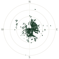
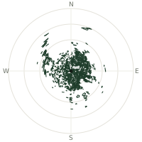
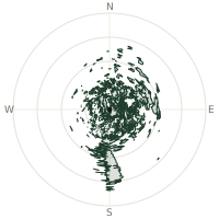
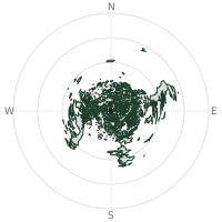
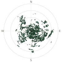
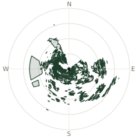
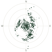
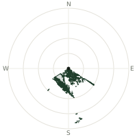
From Crater Lake, the terrain-limited line of sight reaches up to 72.3 km. The single farthest piece of visible terrain lies 72.3 km to the east-northeast (bearing 64°), at 1,878 m elevation. These results account for Earth's curvature and standard atmospheric refraction, computed from 30-meter resolution Copernicus GLO-30 elevation data across 2,229,829 terrain samples.
Open the interactive visibility map →Visibility by direction
The horizon is most open toward the east-northeast, where sightlines run 9.9 km on average; terrain closes the view down fastest to the south, at 0.0 km.
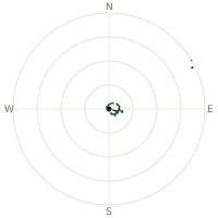
| N | 2.4 km | |
| NNE | 3.1 km | |
| NE | 2.1 km | |
| ENE | 9.9 km | |
| E | 8.7 km | |
| ESE | 7.4 km | |
| SE | 1.4 km | |
| SSE | 0.0 km | |
| S | 0.0 km | |
| SSW | 0.0 km | |
| SW | 0.0 km | |
| WSW | 0.0 km | |
| W | 0.0 km | |
| WNW | 1.0 km | |
| NW | 2.4 km | |
| NNW | 2.3 km |
Farthest named landmarks in view
15 named peaks, hills and headlands stand inside this viewshed. These are the farthest ones you could pick out on a clear day:
| Landmark | Visible distance | Direction | Elevation |
|---|---|---|---|
| Mount Scott | 10.6 km | E · 99° | 2,636 m |
| Cloudcap | 8.4 km | E · 96° | 2,444 m |
| Wineglass | 8.1 km | ENE · 73° | 1,944 m |
| Roundtop | 7.8 km | ENE · 68° | 2,109 m |
| Redcloud Cliff | 7.8 km | E · 91° | 2,361 m |
| Palisades | 7.6 km | ENE · 68° | 1,968 m |
About Crater Lake
Crater Lake in Oregon is the deepest lake in the United States at 594 meters. It fills a caldera formed 7,700 years ago when Mount Mazama collapsed. The pristine blue waters and surrounding rim cliffs create one of North America's most visually striking natural features.
Did you know?
- Deepest lake in United States at 1,949 feet (594 meters) depth.
- The lake's water is among the clearest on Earth, with a historic Secchi-disk clarity reading of over 44 metres — a result of having no streams to carry in sediment.
- No rivers flow in or out; water replaced every 150 years by precipitation.
- Ranks tenth globally for maximum depth; fifth for mean water depth.
Frequently asked questions
How far can you see from Crater Lake?
On a clear day the terrain allows a line of sight of up to 72.3 km from Crater Lake. The average visible distance across all 360 directions is 2.5 km. Atmospheric conditions (haze, humidity) usually reduce practical visibility below the terrain-limited maximum.
What is the farthest point visible from Crater Lake?
The farthest terrain visible from Crater Lake lies 72.3 km to the east-northeast, at an elevation of 1,878 m. Earth's curvature and atmospheric refraction are accounted for in this calculation.
How high is Crater Lake?
The observation point at Crater Lake sits at 2,105 m above sea level (Copernicus GLO-30 elevation model).
How is this visibility map calculated?
UpToWhere traces lines of sight in 360 directions from the observer using 30 m-resolution Copernicus terrain data, correcting for Earth curvature and standard atmospheric refraction. You can run the same analysis for any point on Earth with the free calculator.
Run your own analysis
Want to know what you can see from your house, a summit you're planning to climb, or a plot of land? UpToWhere computes the same 360° viewshed for any point on Earth in seconds — free.
Try the viewshed calculator