 UpToWhere
What can you see from Mount Shasta?
California's magnificent volcano: 14,179 feet of andesite and ancient power.
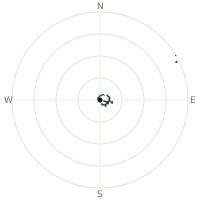
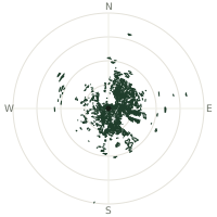
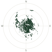
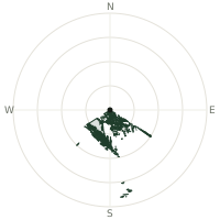
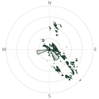
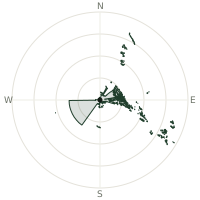
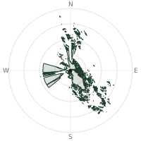
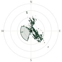
From Mount Shasta, the terrain-limited line of sight reaches up to 320 km. The single farthest piece of visible terrain lies 320 km to the south (bearing 178°), at 446 m elevation. These results account for Earth's curvature and standard atmospheric refraction, computed from 30-meter resolution Copernicus GLO-30 elevation data across 2,481,151 terrain samples.
Open the interactive visibility map →Visibility by direction
The horizon is most open toward the south, where sightlines run 260 km on average; terrain closes the view down fastest to the west-southwest, at 114 km.
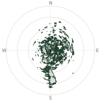
| N | 199 km | |
| NNE | 203 km | |
| NE | 177 km | |
| ENE | 186 km | |
| E | 170 km | |
| ESE | 184 km | |
| SE | 192 km | |
| SSE | 155 km | |
| S | 260 km | |
| SSW | 173 km | |
| SW | 148 km | |
| WSW | 114 km | |
| W | 117 km | |
| WNW | 131 km | |
| NW | 171 km | |
| NNW | 177 km |
Farthest named landmarks in view
851 named peaks, hills and headlands stand inside this viewshed. These are the farthest ones you could pick out on a clear day:
| Landmark | Visible distance | Direction | Elevation |
|---|---|---|---|
| Tumalo Mountain | 292 km | N · 9° | 2,370 m |
| China Peak | 283 km | S · 180° | 344 m |
| Buck Mountain | 276 km | S · 184° | 839 m |
| Lytle Mountain | 274 km | S · 182° | 636 m |
| Billys Hill | 274 km | S · 183° | 524 m |
| Jackson Mountain | 268 km | S · 182° | 841 m |
About Mount Shasta
Mount Shasta rises as the second-highest peak in the Cascade Range, after Mount Rainier, and is the most voluminous stratovolcano in the Cascade Volcanic Arc. Built through four major cone-building episodes over millennia, its last eruption occurred approximately 3,200 years ago, making it a powerful monument to geological creation and transformation.
Did you know?
- 14,179 feet—California's fifth-highest peak
- Since the late 19th century, Shasta has drawn New Age pilgrims and mystics who believe a hidden civilization, the Lemurians, lives inside the mountain.
- Several of Shasta's glaciers actually grew during the late 20th century, bucking the Cascade-wide trend of retreat, before a sharp decline following droughts after 2015.
- Composed of alternating layers of andesite and dacite
- Formed on remnants of collapsed volcano 300,000+ years old
Frequently asked questions
How far can you see from Mount Shasta?
On a clear day the terrain allows a line of sight of up to 320 km from Mount Shasta. The average visible distance across all 360 directions is 172 km. Atmospheric conditions (haze, humidity) usually reduce practical visibility below the terrain-limited maximum.
What is the farthest point visible from Mount Shasta?
The farthest terrain visible from Mount Shasta lies 320 km to the south, at an elevation of 446 m. Earth's curvature and atmospheric refraction are accounted for in this calculation.
How high is Mount Shasta?
The observation point at Mount Shasta sits at 4,312 m above sea level (Copernicus GLO-30 elevation model).
How is this visibility map calculated?
UpToWhere traces lines of sight in 360 directions from the observer using 30 m-resolution Copernicus terrain data, correcting for Earth curvature and standard atmospheric refraction. You can run the same analysis for any point on Earth with the free calculator.
Run your own analysis
Want to know what you can see from your house, a summit you're planning to climb, or a plot of land? UpToWhere computes the same 360° viewshed for any point on Earth in seconds — free.
Try the viewshed calculator